Roadway culverts silently convey streams, rivers and stormwater under roads and highways for many years without much thought from the average roadway user. However, to New Hampshire municipal highway departments, they have been a source of frequent problems. Culverts have supported roads over waterways since the first settlers came to New Hampshire. Much of the underground drainage infrastructure currently in service was installed during the federal highway construction boom after World War II. Many have reached the end of their usable service life, with some catastrophically failing during extreme rainfall events experienced in recent years.
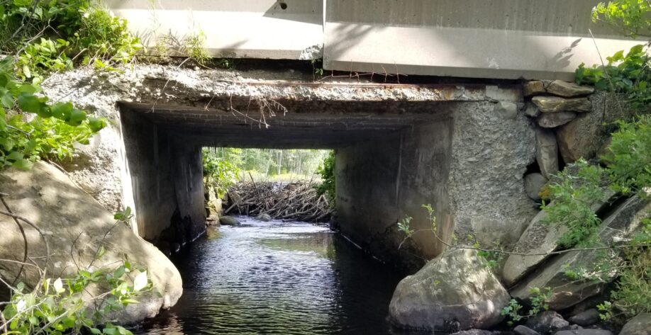
At first, culverts were installed with conduits readily available to municipalities with little thought to the volume of runoff being conveyed. Later, culverts were sized to convey a specific design storm; however, these methodologies, such as the width of the stream under “normal” flow, were found to be less accurate. In addition, many of the methodologies varied greatly between federal, state, and local agencies. Over the last decade, significant progress has been made by State agencies to improve and standardize culvert design. Size is no longer limited to a particular design storm but is based on several different factors used to provide a comprehensive design that addresses flow capacity; reduces flooding; provides storm resiliency; and increases aquatic and wildlife passage. Perhaps the biggest change in culvert design is the concept of stream simulation or the goal of maintaining the physical and biological integrity of the stream system including existing populations of fish and other wildlife species. Stream simulation is accomplished by reproducing stream features within the culvert such as stream banks, stream slope, streambed aggregate and larger key elements.
The process of stream simulation culvert design begins with field reconnaissance and survey where field conditions, measurements, materials, and topography are cataloged and recorded. The field data is compiled and combined with online and record data, if available, and a stream model is developed. The replacement culvert size is selected using the field reconnaissance findings and river model. The replacement culvert is located based on stream alignment and slope on a plan prepared using the survey data. The stream material requirements and key element specifications and locations are also included on the plan.
Gale Associates, Inc. has the experience to perform existing condition assessments, hydrologic and hydraulic (H&H) modeling, permitting, and administer construction of many culvert and bridge replacements for municipal clients; some of which were installed under an accelerated construction schedule. Gale understands culverts are more than just a roadway over a natural crossing but need to properly convey runoff during extreme storm events, support wildlife habitat, and be low maintenance with better storm resilience. Our project experience has shown that these design elements have commonly provided reduced wildlife mortality, reduced debris clogging and fewer roadway and property flooding incidents.
Tagged In:
Civil Engineering